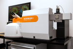
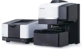
Contains three separate applications for navigating and acquiring Raman images. NavMap is a video feature that shows the whole sample and the zoomed sample’s image in the region of interest simultaneously. NavSharp enables sharp and rapid navigation on a sample image with any topography, keeping the field of view constantly focussed on the sample surface. View Sharp constructs an image in which all surfaces are in focus simultaneously, and creates a 3D topographical image.
- Home
- Techniques
- Directory
- Content
- Topic Focus
- Advertise
- Search_________


